Are you torn between several Ewa Beach pockets that all seem great on paper? You are not alone. The wider 96706 area includes a mix of classic shoreline streets, master-planned communities, and newer townhome clusters that feel very different day to day. This guide gives you a clear way to compare them using commute fit, beach and retail access, housing type, and risk checks. Let’s dive in.
Ewa Beach map basics
“Ewa Beach” can mean the historic shoreline village and also the larger 96706 postal area. The ZIP covers several distinct communities that sit beyond the compact Census‑designated place. When you hear buyers say “Ewa,” they may be talking about anywhere from the beach blocks to master‑planned neighborhoods inland.
Fort Weaver Road is the main north–south route that brings you to the H‑1. It is also a useful mental divider when you compare commute and retail access. Expect different drive times depending on where you live along this corridor. Review the route on a map and note key intersections along Fort Weaver Road.
Key pockets to compare
Use these common pockets when you build your short list. Each offers a different mix of housing types, amenities, and beach or retail proximity.
Ewa Beach CDP shoreline
- Compact beachside blocks with direct access to Ewa Beach Park and local shoreline spots.
- Older homes and cottages show up more often here. Check maintenance history for salt‑air wear.
- Street layouts feel traditional and low rise. Beach access and park proximity are the draws.
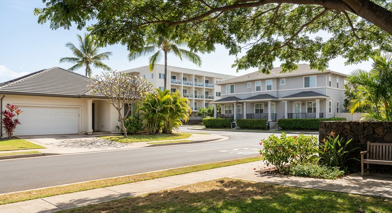
Ocean Pointe and Hoakalei edge
- Master‑planned areas with many two‑story townhomes and single‑family homes near lagoon and recreation features.
- Community amenities and golf access can be part of the lifestyle. Some areas include private or membership‑based facilities.
- Streetscapes are newer. Expect HOA/CC&R rules and fees that vary by sub‑association.
Ewa by Gentry
- Multiple planned neighborhoods with attached townhomes and single‑family product.
- Some sections are gated or have shared amenities like small parks and playgrounds.
- HOA guidelines often cover exterior standards. Review rules and reserves before you buy.
Ewa Villages and older single‑family areas
- Detached homes on larger lots appear more often. Architectural eras vary.
- Pre‑1990 construction can require updates for plumbing, electrical, and windows. Inspect carefully.
- Value drivers include lot size and potential outdoor space.
West‑Ewa near Laulani Village and Ewa Town Center
- Homes close to major retail anchors and services. Convenience is the highlight.
- Mix of newer and established streets with quick access to groceries, pharmacy, and daily needs.
- Expect more frequent car trips but shorter errand times.
Kalaeloa, Barbers Point, and Oneʻula Coastline
- Access to Oneʻula Beach Park and other shoreline points depends on exact location and access paths.
- Zoning and ownership vary. Confirm public access, parking, and any restrictions.
- Strong appeal for beach and open‑space seekers who prioritize coastal time.
Housing types and upkeep
Across Ewa you will find a clear mix: townhomes and condos in master‑planned pockets, newer single‑family homes with modest yards, and older detached houses that may sit on larger lots. Many homes built from the 2000s onward use common double‑wall construction on Oʻahu. Older stock often benefits from documented maintenance. Ask for the year built, notable upgrades, and any coastal exposure items like corrosion control or window replacements.
Townhomes and condos usually trade at lower total prices than detached homes, but HOA fees and price per square foot can change the value story. Compare monthly costs side by side, not just list prices.
Daily needs, parks, and beaches
When you compare pockets, map daily life first. It helps you narrow fast.
- Groceries and services: Ewa Town Center groups Foodland, pharmacy, and everyday services. See the Ewa Town Center directory for a sense of what is on site.
- Larger anchors: Laulani Village adds Safeway, hardware, and more. The center’s build and anchor mix is outlined in this Laulani Village overview.
- Regional mall: For movie theaters, national retailers, and medical clinics, Kapolei’s Ka Makana Aliʻi is the main hub for West Oʻahu.
- Beaches and parks: Ewa Beach Park and Oneʻula Beach Park are the primary shoreline parks many locals use for picnics, fishing, or surfing. Browse a quick local round‑up of family activities to set expectations for Ewa Beach parks and outings.
- Future amenities: The City’s Ewa and Kalaeloa open‑space planning outlines ideas for shoreline parks and regional facilities. Read the City code section on Ewa/Kalaeloa park planning for background.
Commute and transit checks
Ewa relies on the H‑1 east–west spine, and Fort Weaver Road is the key link out. Peak periods vary by direction and by special event days. Here is how to test commute fit for your exact routine:
- Plug your top two work or school addresses into your map app. Check live travel times for your usual AM departure and PM return on two weekdays.
- Note which segment drives the delay. Many buyers find the Fort Weaver approach is the pinch point.
- If you plan to use transit, review Skyline rail updates and TheBus route changes. Honolulu’s rail project posts official notices on HART’s site. Recent route changes designed to connect West Oʻahu to rail are covered in local transit updates.
- Use the HOLO/TheBus trip planner to time transfers from your pocket to the nearest rail station.
Small tip: Test a Saturday late morning and an evening beach return too. Weekend shopping or beach trips follow different traffic patterns than weekday commutes.
Coastal hazards to review
Parts of the Ewa shoreline and the broader leeward plain are low‑lying. Sea‑level rise models and combined coastal hazard studies show sensitivity in several near‑shore areas at moderate scenarios. If you are considering a beach‑adjacent home, include these checks in your offer process:
- Read a peer‑reviewed overview of coastal exposure that highlights Ewa’s sensitivity to combined hazards at moderate sea‑level scenarios: island coastal hazards study.
- View tsunami evacuation zones and plan routes from your exact block using the State’s tsunami evacuation map.
- Compare multi‑scenario sea‑level‑rise exposure using NOAA and partner models. Start with the Climate Central HI sea‑level viewer at 1, 2, and 3 feet.
- Check beach water‑quality advisories before swimming. The Honolulu Star‑Advertiser has reported periodic Mamala Bay advisories. See an example of elevated bacteria advisories.
Also look up FEMA flood status for the specific address and ask about elevation certificates if relevant for lending or insurance. Your inspector can help you assess site drainage and maintenance items that improve resilience.
Pocket‑by‑pocket quick takes
Use this neutral snapshot to focus your tours. Always verify specifics inside each micro‑neighborhood.
- Ewa Beach shoreline: Strong for direct park and beach access. Expect older structures and unique maintenance profiles. Check flood and tsunami resources early.
- Ocean Pointe and Hoakalei edge: Newer feel with many townhomes and single‑family homes. Amenities and HOA standards shape the lifestyle. Compare HOA fees and included services.
- Ewa by Gentry: Planned neighborhoods with a range of attached and detached options. Some gated areas and small community parks. Review CC&Rs for exterior and rental rules.
- Ewa Villages and older detached pockets: Larger lot potential and detached living. Prioritize inspection scope for systems and coastal wear.
- Laulani Village and Ewa Town Center area: Convenience to groceries and services. Shorter errand times. Check your preferred routes to H‑1.
- Kalaeloa, Barbers Point, Oneʻula: Beach and open‑space appeal. Confirm access points and review hazard resources.
Use this comparison checklist
Score each pocket for the way you live. Give each category a weight that fits your priorities.
- Housing match: Product type, year built, and typical size that fits your household.
- Lot and outdoor space: Yard size, privacy, shade, and room for future projects.
- HOA and fees: Monthly dues, reserves, and rules that matter to you.
- Daily needs: Drive times to your primary grocery, pharmacy, urgent care, and Ka Makana Aliʻi for mall‑scale shopping.
- Beach and park access: Distance to the nearest public park or beach and typical parking availability. Check posted advisories when relevant.
- Commute fit: AM and PM drive times, bus and rail connections, and which direction is slowest. See HART updates.
- Risk and resilience: FEMA flood zone, sea‑level viewer results, and tsunami evacuation zone.
- Resale and liquidity: Days on market and turnover trend in your target pocket. Ask your agent for a current MLS snapshot when you are ready to write.
- Walkability and micro‑amenities: Sidewalks, small parks, coffee or food options, daycare or medical proximity.
- Noise and surroundings: Distance to arterials, rail corridors, or active facilities. Visit at different times of day.
Here is a simple scoring matrix you can copy into your notes:
| Criteria | Weight | Pocket A | Pocket B | Pocket C |
|---|---|---|---|---|
| Housing match | ||||
| Lot/outdoor space | ||||
| HOA and fees | ||||
| Daily needs access | ||||
| Beach/park access | ||||
| Commute fit | ||||
| Risk and resilience | ||||
| Resale/liquidity | ||||
| Walkability/micro‑amenities | ||||
| Noise/surroundings | ||||
| Total (weighted) | 100 |
Plan smarter tours
- Tour two pockets in one morning to feel the difference in streets, sun, and wind.
- Stop at the nearest grocery or coffee spot between showings to test convenience.
- Drive your commute route at least once from each pocket. Do an evening return too.
- If a home is near the shore, bring the hazard checklist. Pull up the tsunami map and sea‑level viewer while you are on site.
Ready to compare homes with a clear plan and local insight? For tailored guidance, bilingual support, and a data‑plus‑design approach to your search, connect with Sue Jo. We will help you narrow to the right pocket, line up smart tours, and write a confident offer.
FAQs
What areas are included when people say “Ewa Beach”?
- Locals may mean the historic shoreline village or the wider 96706 postal area that includes master‑planned communities inland. Use Fort Weaver Road as a practical divider when comparing access and commute.
How do I check if a beachside home is in a tsunami evacuation zone?
- Enter the address in the State’s interactive tsunami evacuation map and confirm your nearest evacuation route before you make an offer.
Where do most Ewa residents shop for daily needs?
- Many use Ewa Town Center and Laulani Village for groceries and services, with regional trips to Ka Makana Aliʻi in Kapolei for larger retail and entertainment.
Is there rail service that helps Ewa Beach commuters?
- Honolulu’s rail project posts official service updates on HART’s site. TheBus routes have been restructured to improve West Oʻahu connections to rail, as covered in local transit updates.
Which Ewa Beach pocket is closest to the shoreline parks?
- The Ewa Beach shoreline blocks are near Ewa Beach Park, and the Kalaeloa and Oneʻula areas provide access to Oneʻula Beach Park. Always confirm public access points and parking before you go, and check current advisories for swimming.